Analog Explorer

The Analog Explorer shows field research sites on Earth with similar environments on other worlds. Pairs like these are called planetary analogs. Research at analog locations on Earth helps scientists to make sense of our solar system.

A SCUBA diver practices sample collection underwater, on the seafloor.

Lava Caves: California and the Moon

Naturally-occurring lava caves may someday shelter astronauts on the Moon and Mars from harmful radiation. (Images not to scale.)

Near Medicine Lake Volcano in California, scientists explore lava caves from both inside and out, working towards a future in which astronauts will be able to detect hidden caves from above ground. The lunar lava caves that have been found so far are much bigger than the largest ones on Earth. This opening in the Moon’s surface measures 65 meters (213 feet) across.
California Credit: NASA/UMD/Ernie Bell Moon Credit: NASA/GSFC/Arizona State University

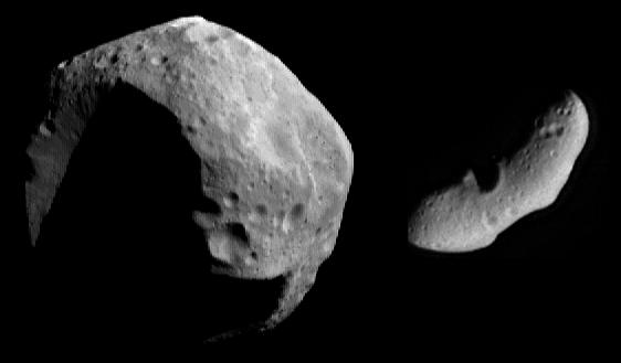
Impact Evidence: Meteor Crater and the Moon

Impact sites on Earth can tell us about the history encoded in craters on other worlds. (Images not to scale.)

Space objects have battered planetary surfaces in our solar system since its formation. On worlds like Earth, weather and erosion quickly erase most of the evidence. The Moon, with little atmosphere and no weather of its own, keeps a much more complete record of our solar system’s history. Careful study of the craters still present on Earth helps us to understand what this history means. The lunar crater shown here is called Copernicus. If these two images were shown to scale, Copernicus Crater would be about 70 times as wide as Meteor Crater.
Meteor Crater Credit: USGS Moon Credit: NASA/ASU

Looking for Life: Arizona and Mars

How do signs of ancient life change over time? Earth’s saltiest lakebeds can help us find out.

In Arizona’s Verde Valley, scientists use field and lab research to learn how signs of life, or biosignatures, are preserved. This kind of work helps robotic explorers like NASA’s Curiosity rover, shown here at the base of Mount Sharp, know what to look for on Mars-- and helps the researchers back home to understand what they find. The Curiosity Rover is about the same size as a large SUV.
Arizona Credit: NASA/Svetlana Shkolyar Mars Credit: NASA/JPL-Caltech/MSSS

Looking for Life: Turkey and Mars

Sediments at Lake Salda’s edge hold clues about the history of Jezero Crater, an ancient Martian lakebed. (Images not to scale.)

The light-colored sediments seen at the edge of Lake Salda, in Turkey, may have formed with the help of tiny living things. In Jezero Crater, a place on Mars that has geological and mineral characteristics in common with Lake Salda, NASA’s Perseverance Rover is searching for similar signs of ancient life. Evidence of a former river flow along Jezero’s rim suggests that this crater was once a vast lakebed. Lake Salda is similar in size to the oval-shaped landing area, shown here, that Perseverance targeted for landing.
Turkey Credit: NASA/USGS Mars Credit: NASA/JPL-Caltech/MSSS/JHU-APL/Purdue/USGS

Icequakes: Alaska and Enceladus

The same technology that measures earthquakes can also detect the motion of subsurface oceans. (Images not to scale.)

Alaska’s Gulkana Glacier and Saturn’s moon Enceladus have secrets in common: liquid water concealed by a thick layer of dirty, rocky ice. Icequake-detecting experiments at Gulkana Glacier lay the groundwork for future measurements on Enceladus-- but no lander has yet touched down on that frozen world. This image of Enceladus was taken from about 14,000 kilometers (9,000 miles) away. Its scale is 81 meters (267 feet) per pixel.
Alaska Credit: NASA/UMD/Nick Schmerr Enceladus Credit: NASA/JPL/Space Science Institute

Land Ripples: Iceland and Mars

Aerial views reveal shifting ridges on these planets’ windswept surfaces. (Images not to scale.)

Researchers in Iceland’s Vikursundar region, at the foot of Askja volcano, survey and monitor large ripples in the landscape’s gravelly surface (left). These ripples are sluggish, moving only under the most extreme weather conditions. Year after year, the team uses science instruments mounted on small drones to capture digital terrain models of the landscape, revealing changes over time. Mars, too, has slow-moving land ripples (right). The Martian ridges shown in this Mars Reconnaissance Orbiter image are ten times the size of the ones in Iceland. The field of view on the left is 300 meters or 1000 feet wide, compared to three kilometers (almost two miles) on the right.
Iceland Credit: NASA/Howard U/Stephen Scheidt Mars Credit: NASA/JPL/University of Arizona

Basalt Landscapes: Kilauea and the Moon

Mission simulations in Earth’s most Moon-like places bridge the gap between past and future exploration.

On the slopes of Hawaii’s Kilauea Volcano, researchers use aerial cameras and hand-held science instruments to characterize their surroundings. Their goal: to determine how long it would take a small team of geologists and astronauts to perform the same kinds of tasks in a different volcanically-formed environment, like the lunar surface. Future crews will draw on lessons learned from both modern mission simulations at sites on Earth and the Apollo missions. (Shown here: Apollo 15 astronaut at work near Hadley Rille on the Moon.)
Kilauea Credit: NASA/Andrea Jones Moon Credit: NASA

Looking for Life: Utah and Mars

Brines and salts found throughout our solar system may play a big role in habitability.

The salts found in Utah’s Pilot Valley are exceptional and ordinary at the same time. Perchlorate, a salt that stores energy so well it’s used as an ingredient in solid rocket fuel, has been observed in many places on Mars. (Shown here: the Martian northern plains.) On Earth, tiny life forms use this same kind of salt as an energy source. Recent data suggests that perchlorate is common throughout our solar system, including on ocean worlds like Jupiter’s moon Europa. If microbial life exists beyond our planet, or if it ever did in the past, knowledge of these salts may someday help scientists to recognize it. The solar panel array in the Mars image is part of NASA’s Phoenix lander and is about the size of a large dinner table.
Utah Credit: Courtesy of Dr. Kennda Lynch Mars Credit: NASA/JPL-Caltech/U Arizona

Shield Volcanoes: New Mexico and Venus

Earth’s lava landscapes help us to understand volcanic processes on other worlds. (Images not to scale.)

Shield volcanoes like Sif Mons, the low mountain near the right-hand horizon in this computer-generated image of Venus, are common on planets and moons throughout our solar system. Planetary volcanologists test scientific hypotheses about how volcanoes form at sites like Aden Crater, a shield volcano in New Mexico. The two prominent Venusian mountains shown here are about 750 kilometers, or 453 miles, apart.
New Mexico Credit: NASA/Lora Bleacher Venus Credit: NASA/JPL-Caltech

Rocky Reconnaissance: California and Mars

Robotic explorers test their capabilities against rugged terrestrial landscapes before leaving home.

The Viking landers were the first to return images from the Martian surface, but the views they sent home were familiar. Utopia Planitia, as seen by Viking 2, looks a lot like Death Valley National Park. It’s no coincidence that NASA’s Mars 2020 team practiced hazard avoidance here before sending Perseverance and Ingenuity on their way to Mars.
California Credit: NASA/Andrea Jones Mars Credit: NASA/JPL-Caltech

Looking for Life: the Atacama Desert and Mars

This portable lab examines Earth’s most barren soils.

Chile’s Atacama Desert, one of the driest places on Earth, helps us to understand how the building blocks of life might respond to Martian conditions over time. The science instruments in this truck can detect very small amounts of target molecules in the sun-baked soil. Robotic explorers like NASA’s Perseverance Rover, shown here with rotorcraft Ingenuity in the background, use their own portable lab instruments to search for biosignatures on Mars. Perseverance is slightly taller than the human researchers, and Ingenuity is just nineteen inches tall.
Atacama Desert Credit: NASA/Marco Castillo Mars Credit: NASA/JPL-Caltech/MSSS

Subsurface Ice: Iceland and the Lunar South Pole

Explorers search for buried ice on Earth using ground-penetrating radar. (Images not to scale.)

Scientists use ground-penetrating radar to find buried ice near Askja volcano in Iceland. The same technology will help future lunar explorers to detect water ice beneath the lunar surface in permanently shadowed regions near the lunar South Pole. Humans have not yet set foot on this part of the Moon, and even if there were astronauts in this view, they would be much too small to see. The large crater near the center of this image is about 100 kilometers (62 miles) wide.
Iceland Credit: NASA/Cherie Achilles Lunar South Pole Credit: NASA
Keep Exploring

Discover More Topics From NASA