
Benjamin Hamlington
Research Scientist, Sea Level and Ice - NASA's Jet Propulsion Laboratory (JPL)
Washington University in St. Louis
B.S. Aerospace Engineering
Washington University in St. Louis
M.S. Mechanical Engineering
University of Colorado at Boulder
Ph.D. Aerospace Engineering Sciences
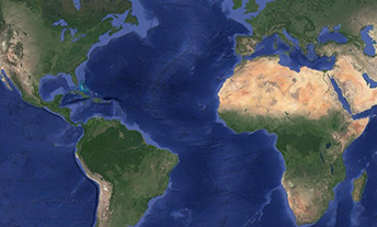
When I was younger, I was always interested in space and the space program (NASA), and I was fascinated by pictures of Earth that were taken from space, and just how expansive and big Earth looked from up above.
I was always interested in science, but what really sparked my interest in what I'm doing now is that I started to understand the kinds of observations we can make from space and the type of science that we can do. It's incredible how accurately and with how much detail we can measure Earth and the ocean from space. It has always seemed like a really fascinating science problem to me.

My great-great-grandfather was a scientist and an engineer, and I always had good conversations with him. He was actually an inventor and he had a lot of inventions that looked at engineering and science problems a little bit differently, and that kind of perspective always was very interesting to me.
My dad worked for the government throughout his career, and I really got a sense of trying to contribute to a national effort and the greater good of the nation. That appealed to me to work for NASA’s Jet Propulsion Laboratory (JPL) and to shift out of academia into a government-type position.
A lot of my initial education was in aerospace engineering and fluid mechanics. When I started my Ph.D., I connected with an advisor who was working on studying the ocean from space. A lot of the same fluid dynamics problems that I had studied previously were applicable to what was going on in the ocean. That really sent me off on this path of understanding the types of problems you can study from space – that is, using observations from space – and the interesting science you can get into. That was really the starting point there.
Over time, it slowly shifted into a connection to climate change, how our ocean and our climate are changing over time, and understanding exactly how the satellites that NASA builds and operates can be used to improve our understanding of that change.
One other thing that's relevant too: prior to starting work at JPL I was an assistant professor in Norfolk, Virginia. Norfolk is an area that's really affected by sea level rise and coastal flooding. It’s really a poster child for the ongoing issues we see with climate change and the effects of rising sea levels. I got that firsthand experience there, in living with sea level rise and coastal impacts. It added a new perspective to the work I'm doing. It really starts to hit home when you're affected several times a year by coastal flooding – they call it high tide flooding – and just having to adapt and worry about it as part of your day-to-day life. For a lot of coastal inhabitants, it's something that you must reckon with every day.
One of my main responsibilities is leading the NASA Sea Level Change Science Team. There are two objectives for that team:
The core scientific objective is to improve forecasts of regional, relative sea-level change. This means improving our understanding of how sea level is going to change in the future. This an interdisciplinary team that I'm leading that's trying to solve really difficult science problems, relying on NASA observations and resources.
The second objective is to make the information we generate useful. We’re connecting with stakeholders in coastal communities to understand their needs and then producing tools that could be used for planning efforts along the coast. A lot of my time is spent leading that team.
In terms of research, I do a lot of work with satellite altimetry to understand not just how sea levels change on very long timescales, but also the ups and downs that occur year-to-year or over the course of decades, and how those combine to drive coastal flooding up the coast.
My advice is that you don't have to focus on any particular area. You don't have to get a Ph.D. in climate science. But learn to understand the tools we use to observe Earth, and how those tools allow us to understand different parts of the climate system. From there you can get into the science of it.
I was an engineer who became a scientist. That was a big challenge. I do think that's benefited me in my career – having an engineering background and then transitioning to science. But there are still these barriers between the disciplines, and I know NASA is an ideal place to try to break down those barriers. That connection between engineering and science is something that NASA does really well.
One group that inspires me in particular: the people who are actually at the coast trying to do something with their local communities or at the state level about climate change and the flooding issues we're facing. It's such a challenging problem for them. They're trying to understand the science and then to make it understandable and usable for a more general audience. Just the extent to what they're doing and the difficulty of their job and the ability to keep working and keep making progress – that inspires me to keep going and do better. It certainly underpins quite a bit of the work with the sea level change team as well.
My favorite projects are the ones where I get to work on interesting problems with people who are very interested in collaborating.
I really like the work of the sea level change team. It's a great team. It's a very friendly, open environment, very collaborative. Separately, I'm part of the NASA Ocean Surface Topography science team – the satellite altimetry science team. I've been involved with that team since my first year of grad school.
I've got two young daughters. Obviously, they occupy a great deal of my time. I definitely enjoy trying to do my best science and showing them some of the cool stuff that I do.
I play a lot of sports. I play in a soccer league, I play tennis, and I do a lot of running – so trying to stay sane through exercise with everything else going on.
I moved around. My dad was with the NSA with the U.S. government, so we moved around a lot. Growing up, I got to travel. I lived in England for quite a while and went to school there. So I got to experience a lot of the world through travel. Travel helps to understand the global nature and the global impacts of the work that we're doing. It truly is a global problem. The impacts are different everywhere around the world, but it really is a global problem affecting everyone, so my upbringing gives me a little bit of that global perspective.
The one I spend the most time looking at is the satellite altimetry map of sea level trends – just trying to understand what underlies it is such an important thing. Just the ability of the program managers and all the scientists and engineers at NASA who have built this record of altimetry across several missions for almost three decades now – it's just amazing how powerful that information is. To be able to get such a global view of how the ocean is changing over those three decades, it's really interesting scientifically. But also recognizing everything that went into generating that image and that data, it's really a powerful thing for me.

Planetary science is a global profession.