News | September 13, 2013
Take a Virtual Tour of Vesta With New High-Resolution Images

› Full image and caption
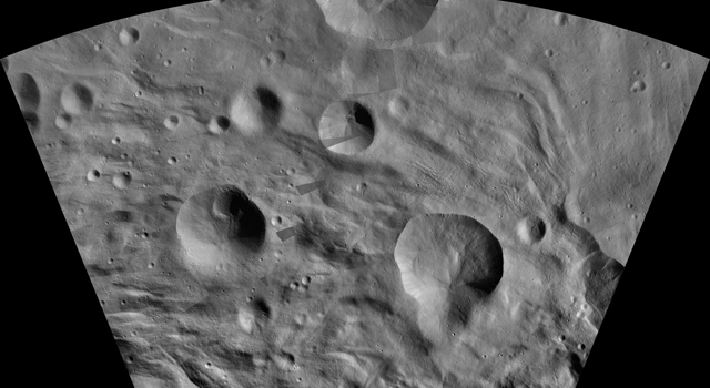
The maps are mostly at a scale about that of regional road-touring maps, where every inch of map is equivalent to a little more than 3 miles of asteroid (1 centimeter equals 2 kilometers).
"Creating the atlas has been a painstaking task -- each map sheet of this series has used roughly 400 images," said Thomas Roatsch of the Deutsches Zentrum für Luft- und Raumfahrt, Germany, who presented the images Sept. 11 at the European Planetary Science Congress 2013 in London.
"The atlas shows how extreme the terrain is on a body the size of Vesta. In the south pole projection alone, the Severina crater contours reach a depth of 11 miles [18 kilometers]; just over 60 miles [100 kilometres] away from the mountain peak towers about 4 miles [7 kilometers] high."
Read the full news release from the European Planetary Science Congress at: http://www.europlanet-eu.org/epsc2013/media-press/76-epsc2013/media-press/621-take-a-virtual-tour-of-vesta-with-new-high-resolution-atlases .
View the images online at: http://dawn.jpl.nasa.gov/multimedia/vesta_atlas_gallery.asp and http://photojournal.jpl.nasa.gov/catalog/pia17480 .
The Dawn mission to Vesta and Ceres is managed by NASA's Jet Propulsion Laboratory, a division of the California Institute of Technology in Pasadena, for NASA's Science Mission Directorate, Washington. The University of California, Los Angeles, is responsible for overall Dawn mission science. The Dawn framing cameras were developed and built under the leadership of the Max Planck Institute for Solar System Research, Katlenburg-Lindau, Germany, with significant contributions by DLR German Aerospace Center, Institute of Planetary Research, Berlin, and in coordination with the Institute of Computer and Communication Network Engineering, Braunschweig. The framing camera project is funded by the Max Planck Society, DLR and NASA.


