6 min read
Editor's note: this list was written in January 2010 as a forecast of upcoming events.
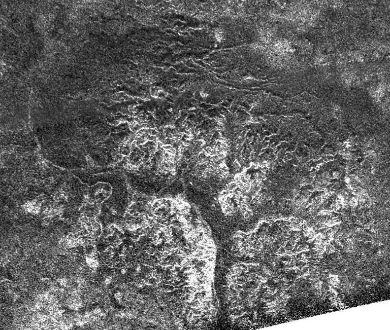
Titan flyby (1,073 kilometers) --T-65: The Cassini spacecraft returns to Titan's south polar region for a close flyby on Jan. 12, 2010. During this pass RADAR gets another view of Ontario Lacus, providing an opportunity to see evaporation at the methane and ethane lake near the south pole. Also, this is the lowest latitude pass in the mission for the Ion and Neutral Mass Spectrometer (INMS), which provides the opportunity to sample deep into the southern atmosphere as well as to measure possible seasonal changes. A similar pass about six months previously can provide a good comparison set of data.
Titan flyby (7,490 kilometers) -- T-66: On this high-altitude encounter, the Imaging Science Subsystem (ISS) will acquire high-resolution observations during and after closest-approach, covering territory from the trailing hemisphere at high southern latitudes northeast to near-equatorial Adiri. On the inbound leg, the Visual and Infrared Mapping Spectrometer (VIMS) will have the opportunity to do one stellar occultation which will allow us to constrain the composition and the spectral properties of Titan's atmosphere.
Rhea flyby (100 kilometers) --R-2: Cassini swoops down to within 100 kilometers of Rhea to “sniff” the satellite. Particle and fields instruments will try to determine what is coming off Rhea.
Cassini flies by Helene at 1,800 kilometers. This satellite is in the same orbit as Dione (it won’t crash into Dione though), and Cassini scientists will get a spectacular, close view to see how similar it is to Dione
Titan flyby (7,462 kilometers) -- T-67: This flyby is the second most important ISS pass in the extended mission. These high (about 7,000 kilometer) flybys were designed for gap filling. On this high-altitude encounter, ISS will perform high-resolution observations during and after closest-approach along the equator from eastern Belet across the trailing hemisphere to western Senkyo, imaging Senkyo at very low phase angles (less than five degrees). The Composite Infrared Spectrometer (CIRS) captures the farthest north vertical profiles of the extended mission, observing the composition and temperature profile at 70 degrees north, and possibly observing the break up of winter/spring vortex.
Dione flyby (500 kilometers) -- D-2: Cassini swoops down to within about 500 kilometers of Dione to “sniff” the satellite. Particle and fields instruments will try to determine if Dione is actively spewing particles.
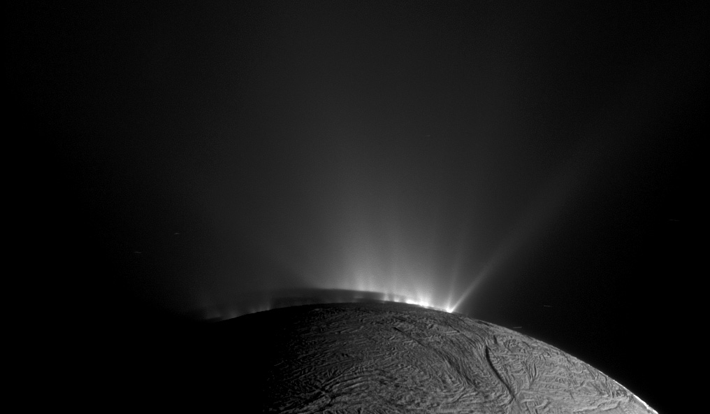
Enceladus flyby (103 kilometers) -- E-9: On this flyby, paired with one on November 30, Cassini Radio Science Subsystem (RSS) tracks Enceladus through a close flyby to determine the nature of the interior right under the hot spot.
Enceladus flyby (438 kilometers) -- E-10: During a targeted Enceladus flyby, the Ultraviolet Imaging Spectrograph (UVIS)watches the sun go behind the plume to understand whether there is any nitrogen in the plume material.
Titan flyby (1,400 kilometers) -- T-68: This is the fifth flyby of the Cassini mission that will be devoted to Titan gravity science. We have two related goals for all gravity science flybys: to measure the fluid and dynamic Love number of Titan and determine Titan's geoid. The determination of the fluid Love number is the only way to find out with confidence whether Titan has a liquid ocean. The determination of the geoid is crucial to understanding the internal structure of Titan through correlative analysis of the gravity and RADAR planetary radii data. The Composite Infrared Spectrometer (CIRS) takes advantage of the farthest south profiles of the entire extended mission.
Cassini passes to within about 50,000 kilometers of Tethys and 70,000 kilometers of Rhea on the same day.
Titan flyby (2,044 kilometers) -- T-69: During this flyby VIMS will be prime at closest approach and will observe the north-pole area. A mosaic of Kraken Mare may be obtained if the north polar hood has vanished. A mosaic of an area north of Adiri will be obtained at a resolution of 10 kilometers per pixel.
Titan flyby (880 kilometers) -- T-70: This is the flyby with highest priority for the magnetometer (MAG). With an unprecedented altitude of 880 kilometers at closest approach (in the dayside ionosphere), the measurements obtained by MAG will provide important pieces of evidence in favor or against the presence of a dynamo generated magnetic field. UVIS captures a stellar occultation outbound from Titan.
Titan flyby (1,005 kilometers) -- T-71: The Ion and Neutral Mass Spectrometer (INMS) looks at the effect of rising solar activity in southern latitudes, with closest approach on the dayside near the terminator. RADAR has a southwestern quadrant ride-along Synthetic Aperture Radar (SAR) of a poorly covered region in the prime and extended mission, valuable for global shape via SAR topo. The day after closest approach is a caboose period, with a fields, particles and waves campaign, featuring the Cassini Plasma Spectrometer (CAPS) as prime instrument.
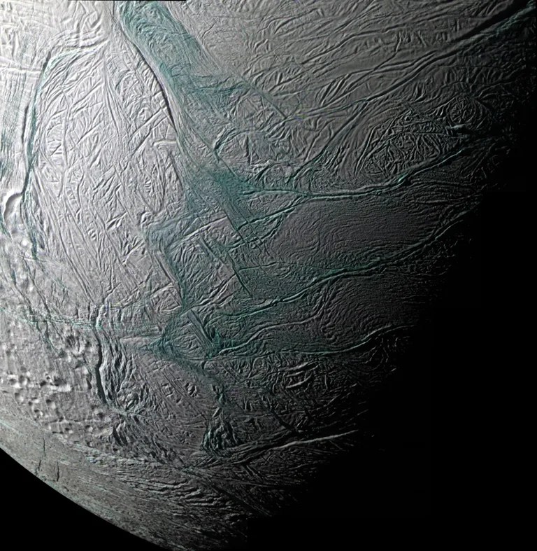
Enceladus flyby (2,554 kilometers) -- E-11: In a 2,500 kilometer targeted flyby of Enceladus, CIRS gets a close view of the tiger stripes to measure their temperature.
Titan flyby (8,175 kilometers) -- T-72: During this high altitude flyby (8,175 kilometers at closest approach), VIMS will map an equatorial region of the trailing hemisphere known as Belet at a resolution of 5 kilometers per pixel. This mosaic will complement the mosaics that will be obtained during T-66 and T-67. Then VIMS will perform a global mapping of Titan looking for clouds at northern mid-latitudes and near the poles. ISS will ride along with VIMS throughout.
Cassini aproaches Pallene to within 36,000 kilometers. This satellite was discovered in 2004 by scientists studying data returned by the Cassini spacecraft. Now we’re going back to get a better view to determine its composition and size as well as its relationship to Enceladus, Mimas, and the E ring. Cassini will obtain the first VIMS spectrum of this moon.
Titan flyby (7,921 kilometers) -- T-73: CIRS focuses on temperature mapping of the stratosphere, including continuing monitoring of the changing vertical structure as the northern hemisphere warms through Titan's northern spring. At closest approach, VIMS will ride along with CIRS and will map the Huygens landing site at medium resolution. CAPS will direct pointing to get a good view of the plasma. Then VIMS will image Shangri-La and Adiri at a resolution of 10 kilometers/pixel. VIMS (and ISS) will also be looking for clouds at mid latitudes. For MAG, T-73 is a pre-dusk, high altitude ( greater than 4,000 kilometer) 'blind' flyby over the south pole of Titan that will be useful to characterize the background field in which Titan sits.
Enceladus flyby (51 kilometers) -- E-12: On this flyby, paired with one on April 28, Cassini Radio Science tracks Enceladus through a close flyby to determine the nature of the interior right under the hot spot.
Enceladus flyby (51 kilometers) -- E-13: The Cassini spacecraft makes a 50-kilometer pass over the north pole of Enceladus. The fields and particles instruments will be trying to “sniff” anything coming from the moon.
Dates are listed in Spacecraft Event Time (SCET), which is the time the something happens at the spacecraft based on Coordinated Universal Time (UTC).

