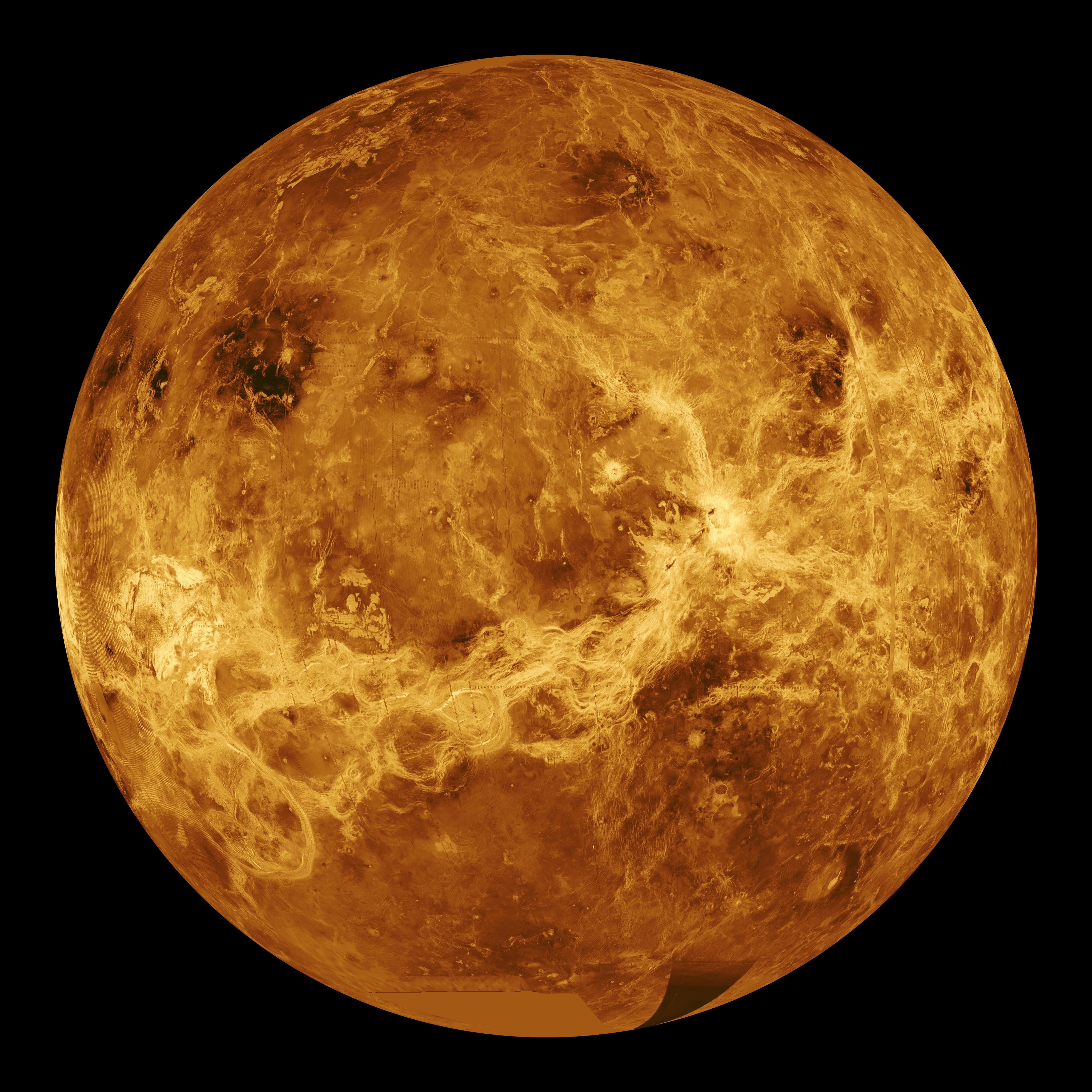
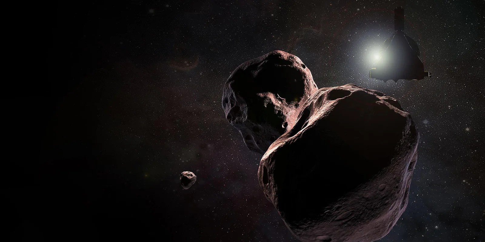
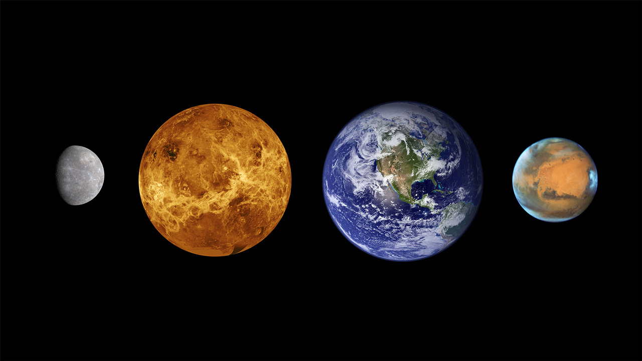
Of all known planets, moons, and newly discovered exoplanets, Venus is the most Earth-like in size, overall composition, and energy received from the Sun. Venus was likely the first habitable planet in the solar system as our young Sun began to heat up, creating the "Goldilocks Zone" – or habitable zone – the range of distance from a star with the right temperatures for water to remain liquid on a planet's surface.
Ancient Venus was likely habitable long before the first life appeared on Earth – but did life emerge there? As the maturing Sun boiled off Venus’ oceans, Earth’s sister planet evolved into its present hellishly hot state – with a thick, toxic atmosphere, crushing air pressure, and surface temperatures hot enough to melt lead. By what processes did Venus lose its oceans and magnetic field, and how and when did plate tectonics shape its surface?
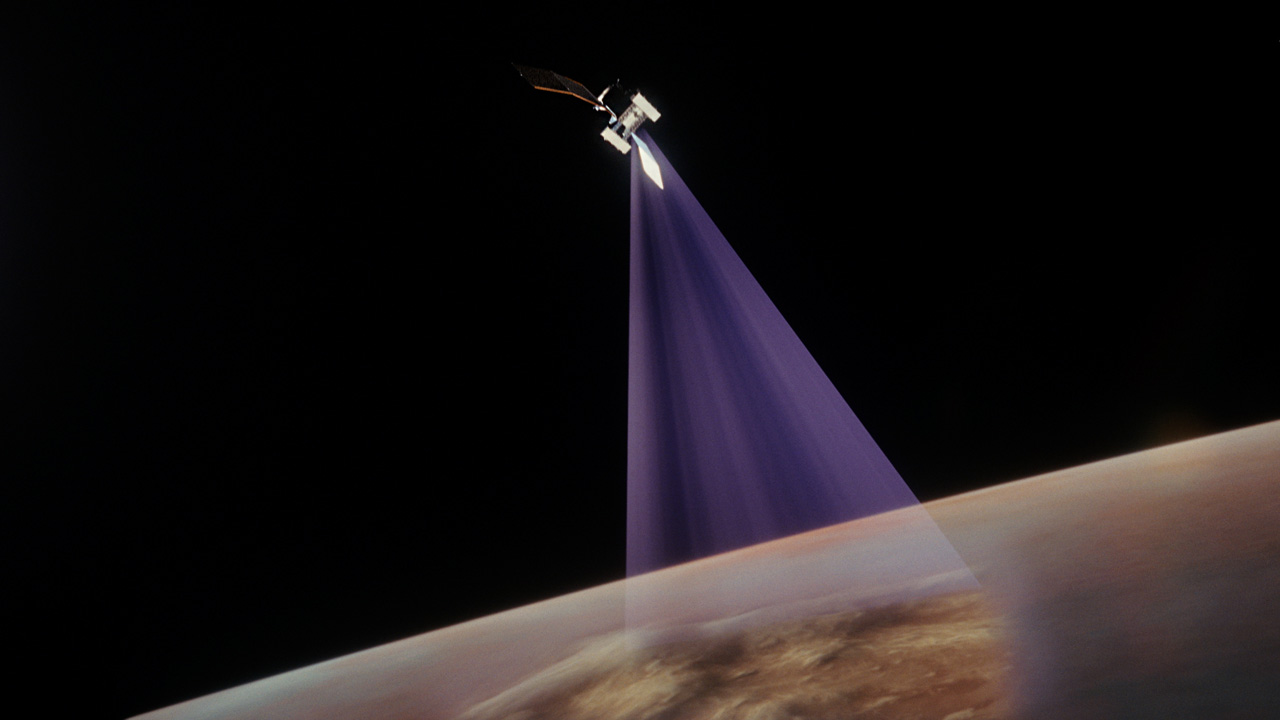
To find the answers, NASA's VERITAS mission will study the planet's surface, and its interior with a powerful new generation of scientific tools. It will create incredibly detailed radar maps of Venus' surface, vastly improving on the maps made by NASA’s Magellan mission in the 1990s. From these data, scientists will make the first high-resolution topographic maps of Venus and the first maps of regions where geologic processes are actively reshaping the surface today.
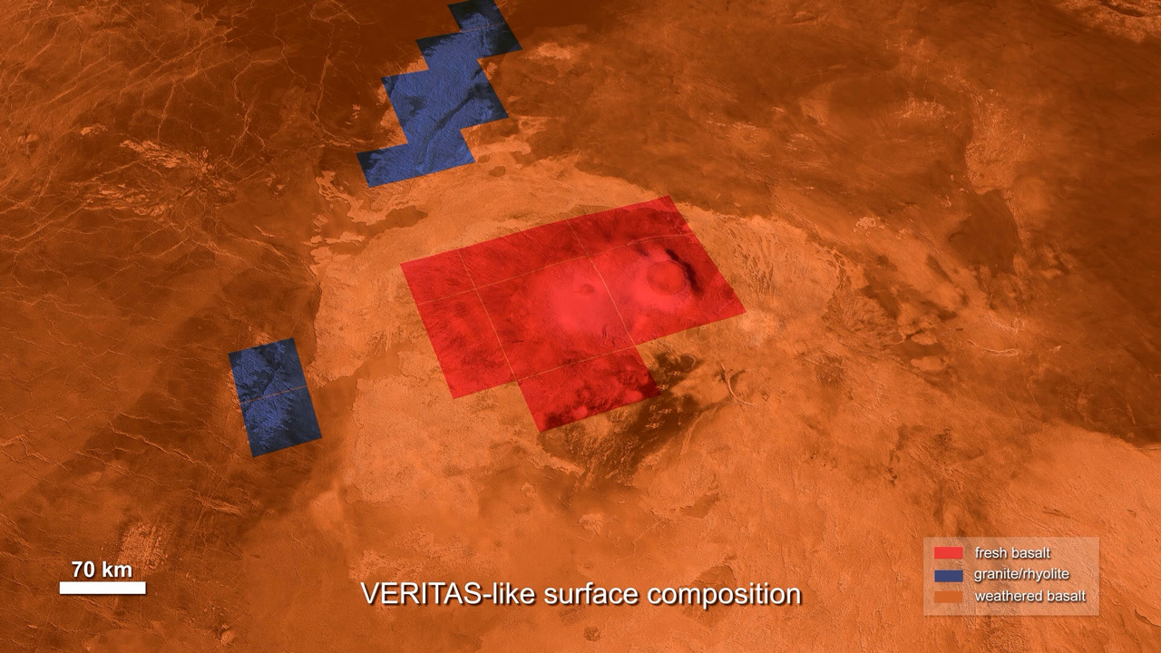
VERITAS also will create the first near-global map of rock types, making it the first mission to reveal the composition and distribution of Venus' surface materials.
Mission Goals
VERITAS will address three main science questions:
1. What processes shape rocky planet evolution?
2. What geological processes are currently active on Venus?
3. Is there evidence of past or present water on Venus?
In order to achieve these goals, VERITAS scientists will chase a variety of mysteries:
- What is the planet's geologic history?
- What are the compositions and origins of the different terrains on Venus: mountains, volcanoes, valleys, highlands, domes, ridges, and impact craters?
- What is volcanic activity like on Venus? Is it constant, or does it come and go?
- What are the major processes that shape the surface and subsurface of Venus?
- What is the size and state of the planet's core? How thick and viscous is the rest of the interior?
- Is the surface today being changed by active volcanoes?
- Are the plateaus on Venus, known as "tesserae," like Earth’s continents? (If so, they indicate a wetter climate in the past.)
- Is water from the interior being released as a gas by volcanoes?
Science Instruments
To pursue VERITAS’ science questions, the mission includes two science instruments and a gravity science investigation.
The radar instrument, known as VISAR, will peer through the dense clouds of Venus to vastly improve our maps of the planet's surface and identify places that are actively being changed by geologic processes. The VEM spectrometer is an infrared imager that represents a powerful new way to look at what types of rocks and minerals are on Venus and where they are located. The gravity science investigation will use the spacecraft's radio communications system to tease out new details about the planet's interior structure and activity.
These measurements work together in a comprehensive investigation of the interactions between the interior, surface, and atmosphere of Venus.
With its science instruments, the VERITAS mission will produce:
- High-resolution topographic maps and radar images
- The first-ever maps showing where the surface is actively being deformed
- The first global maps of rock types and iron minerals for Venus
- Global monitoring for volcanism, including water outgassed by volcanoes
These powerful insights will enable a new range of Venus missions, in much the same way that NASA's Mars Global Surveyor was game-changing for Mars science in the late 1990s.
Venus Interferometric Synthetic Aperture Radar (VISAR)
The VISAR instrument generates global radar maps of Venus' surface and topography, from which VERITAS will answer key science questions about rocky planet evolution. These enormous and rich datasets will be an invaluable resource for a new generation of Earth, planetary, and exoplanet scientists, and will serve as a foundation for many future science studies. VISAR obtains these data using an approach called synthetic aperture radar, or SAR. Used extensively by Earth-monitoring satellites, as well as Saturn's icy moon Titan by NASA's Cassini mission, SAR combines multiple pings from a spacecraft's radar antenna to simulate the sensitivity of a much larger antenna. Doing so gives VISAR and other spaceborne SAR instruments remarkable sensitivity to the surface structure and texture (or roughness) of a planet.
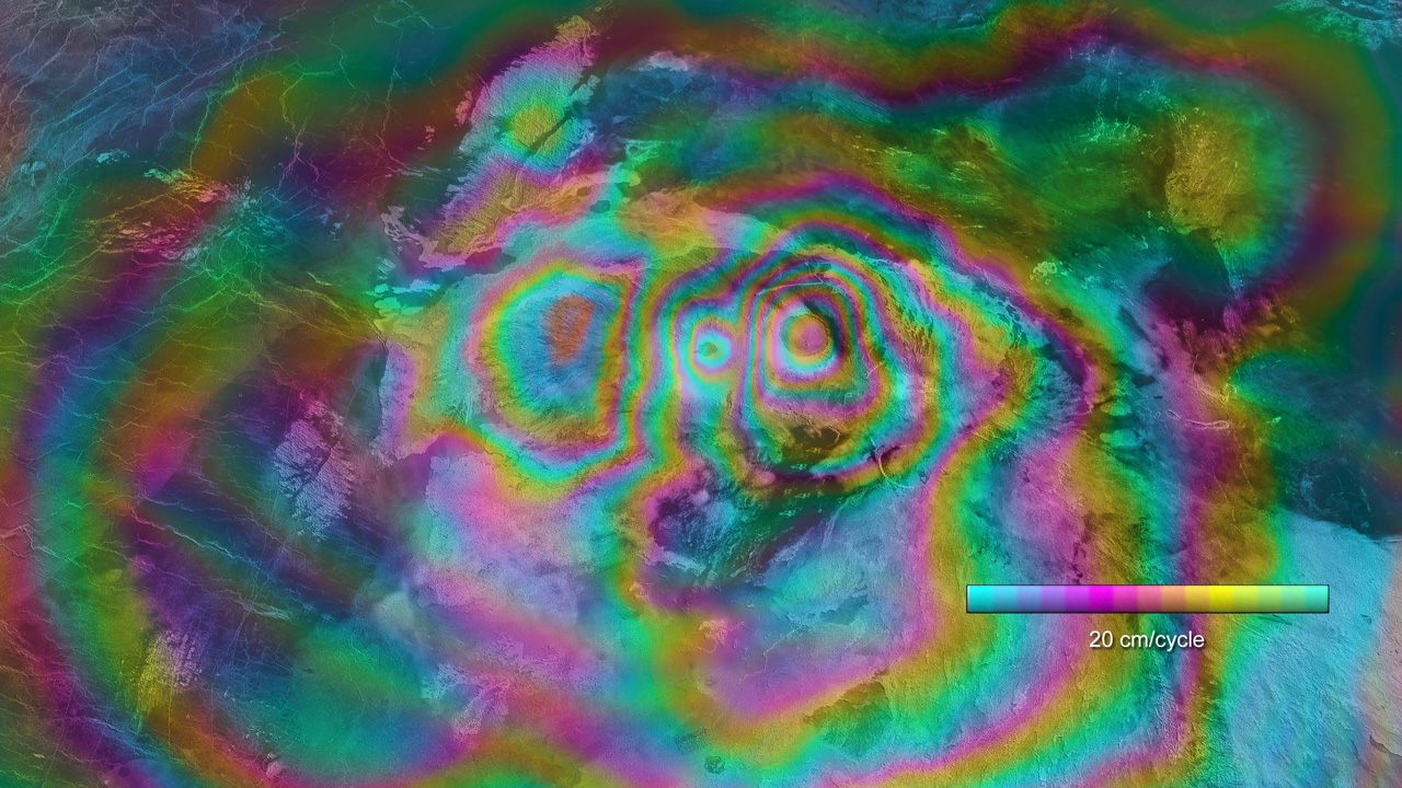
VISAR also will make the first measurements of active deformation on another planet using a technique called interferometry. Multiple radar images of the same location on Venus, obtained at different times, are combined to reveal subtle changes. This new technique for observing Venus is just one way VERITAS will address whether the planet is active today.
VISAR will produce:
- The first global, high-resolution topography
- The first active deformation maps for another planet
The VISAR instrument takes advantage of radar hardware and interferometry advances since Magellan to enable improved mapping of the surface of Venus. VISAR is an X-band (3.8-cm wavelength), single pass interferometer that will acquire both imagery and topography, globally, for the Venusian surface. Global coverage is enabled by onboard processing of the radar data, which reduces the amount of data that must be downlinked by two-to-three orders of magnitude. Radar imagery, acquired at a 32˚ incidence angle, will have 30-meter resolution globally, and 15-meter resolution for about 25% of the planet. VISAR, with its two antennas separated by 3.1 meters, will generate topographic maps with a spatial resolution of 250 meters and a vertical accuracy of 5 meters. Additionally, VISAR will makes the first surface deformation measurements of another planet, using repeat pass radar interferometry. VISAR will target 12 to 18 sites, 200 x 200 kilometers in area, by maneuvering the spacecraft on two passes to stay within a 160-meter-diameter tube, in order to stay within the critical baseline. The expected deformation accuracy is 1.5 cm, which includes SO2 variations in the atmosphere between data takes.
Global Data Sets
- Topography: 5-meter vertical, 250-meter spatial
- SAR imaging resolution: 30 meters
Targeted Data Sets
- SAR imaging high-resolution resolution: 15 meters for ~25% of surface
- Surface deformation: 1.5-centimeter vertical resolution for 12-18 200 x 200 kilometer sites
Instrument Parameters and Data Products
- Single pass radar interferometer
- Two 3.9 × 0.6-meter antennas separated by an interferometric baseline of 3.1 meters
- Spacecraft altitude: 180-250 kilometers
- Radar center frequency and bandwidth: 7.9 GHz and 20 MHz
- Single look range and azimuth resolution: 7.5 meters and 2.2 meters
- Look and incidence angles: 30° and 32°
- Elevation accuracy: 5 meters
- Elevation posting: 250 meters
- Additional high resolution topography products for selected areas (e.g., tesserae)
- Elevation accuracy: 12.5 meters
- Elevation posting: 125 meters
Venus Emissivity Mapper (VEM)
VEM is an infrared imaging spectrometer – an infrared camera that separates the light it receives into its component colors in order to reveal the composition of Venus' surface. Dense clouds of carbon dioxide absorb most of the light from the planet's surface, obscuring the view for conventional cameras and sensors. But VEM will observe Venus’ surface in a narrow range of infrared light wavelengths that pass through the dense clouds and can be detected in space by VERITAS. These wavelengths are near 1,000 nanometers – slightly longer than visible red light, which extends to about 700 nanometers. Making use of these atmospheric windows enables VEM to sense the surface composition and also study the atmosphere for signs of water vapor being erupted by volcanic activity.
Different types of rocks and minerals reflect light in different ways that reveal their compositions. VEM will detect the chemical fingerprints of various surface materials on Venus by providing spectra, or profiles of how bright the rocks appear at different wavelengths of infrared light.
This technique was pioneered at Venus by the VIRTIS instrument on ESA's Venus Express mission. VEM is designed and built by the German Aerospace Center, DLR, and the instrument team includes some of the same researchers who developed the technique for VIRTIS. Building on that experience, VERITAS is greatly enhanced in its spectral and spatial coverage and its sensitivity. To understand the data their instrument will return, the VEM team developed a library of high-temperature spectra for many rock types that might be present on Venus.
VEM data will be collected on Venus’ night side only. This is because reflected sunlight on the dayside overwhelms light at the wavelengths VEM detects – that is, light given off by hot rocks on the surface. At night, emission from the hot rocks provides abundant infrared light for VEM to detect.
VEM will produce:
- The first near-global map of rock type
VEM is a multispectral pushbroom imager that views the surface through five near infrared spectral channels, providing a multichannel, global map of igneous rock type and iron/silica mineralogy as well an estimate of near-surface water vapor from volcanic outgassing.
6 near-IR surface bands with robust signal-to-noise ratio
- 860 ± 20 nm
- 910 ± 30 nm
- 990 ± 15 nm
- 1020 ± 7.5 nm
- 1110 ± 20 nm
- 1180 ± 6 nm
2 water vapor bands
- 960 ±20 nm
- 1150 ± 15 nm
3 cloud bands
- 1195 ± 6 nm
- 1310 ± 15 nm
- 1510 ± 15 nm
3 background reference bands for stray light detection
- 790 ± 10 nm
- 1060 ± 7.5 nm
- 1370 ± 10 nm
Instrument Parameters and Data Products:
- Spatial resolution of 100 × 100 km
- SNR >15 enables discrimination of mafic and felsic surface materials
- 4% relative uncertainty in emissivity
Gravity Science
VERITAS gravity science obtains data that tell us about the deep interior of Venus using a radio signal link between the VERITAS spacecraft and the giant antennas of NASA's Deep Space Network (DSN). Like gravity science investigations on previous planetary exploration missions – including Dawn, Cassini, and Juno – the VERITAS gravity investigation connects the spacecraft's telecom subsystem and dish-shaped high-gain antenna with the DSN to form a giant science instrument spanning the distance between Earth and Venus.
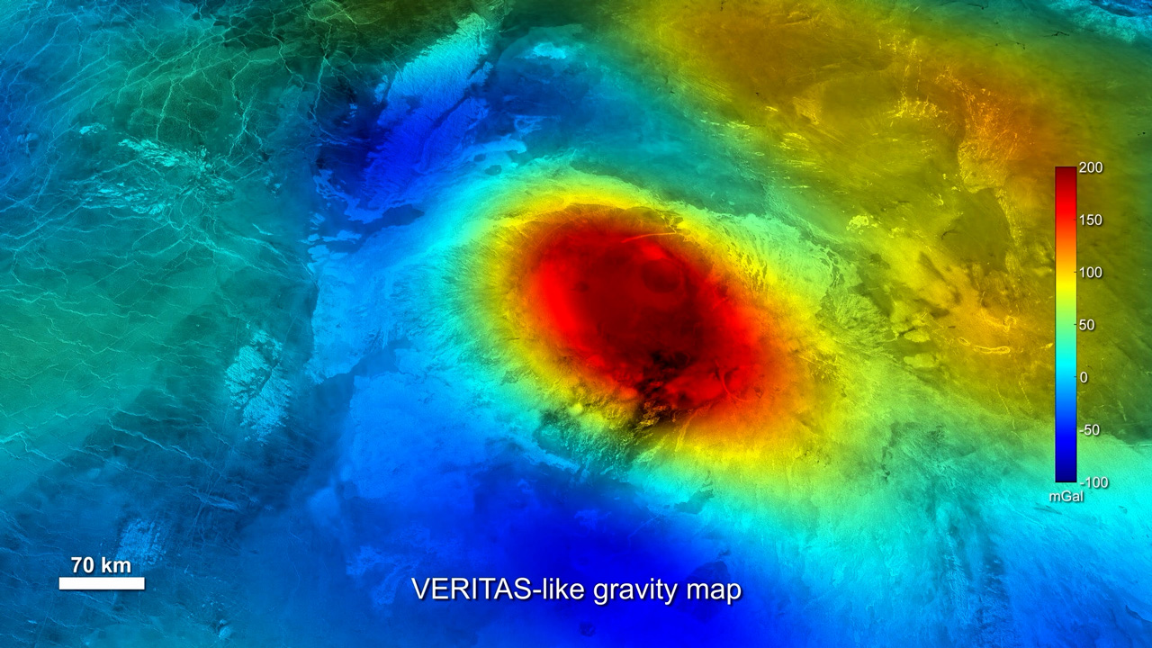
As the spacecraft orbits Venus, it detects small variations in the planet's gravity from place to place that, taken together, correspond to the arrangement of material deep inside the planet, all the way to the core. Gravity science also helps scientists to precisely determine how the planet is rotating, including any wobble on its axis, which also provides powerful insights into the structure and state of the interior.
Knowledge of the interior of Venus is quite limited by the available data. For example, it's currently not known if the core of Venus is liquid or solid. (The planet's lack of a magnetic field does not resolve that question.) And estimates for temperatures in the planet's mantle vary by hundreds of degrees – with the differences having implications for the past evolution of Venus, including its volcanic history. VERITAS gravity science will help make inroads on these and other questions about the interior of Venus.
What we learn from VERITAS gravity science will finally bring knowledge of the Venusian interior up to par with what's already known about the interiors of the other rocky planets, enabling scientists to make useful comparisons between Venus and Earth, Mars, and the Moon.
VERITAS Gravity Science will produce:
- Measurement of the moment of inertia factor (MOIF) – a quantity that describes how material is distributed inside a planet
- Data that help constrain the size and state of the planet's core (liquid vs. solid)
- The first global maps of the thickness of Venus' crust and heat flow, which are clues to a planet's past evolution and interior composition
High-resolution, globally uniform gravity field provides up to 3× improvement over Magellan.
- Two-way Ka-band Doppler data quality: ~0.033 mm/s at 10 s integration time
- Simultaneous coherent radio links at X and Ka bands
- Near-uniform global coverage of lithosphere and crust at 200-kilometer spatial resolution with 7 mGal accuracy
- Determine k2 to ± 0.01
- Measure tidal lag to ± 0.25°
- MOIF to ±0.005 from pole precession to ± 50 arcseconds
VERITAS Publications
Papers and technical presentations by the VERITAS team
From March 2022, IEEE:
- (Smrekar et al.) VERITAS (Venus Emissivity, Radio Science, InSAR, Topography, and Spectroscopy): A Discovery Mission

