NOTE: Click on the image to view it at its highest resolution.
P-38722 MGN-74
October 21, 1991
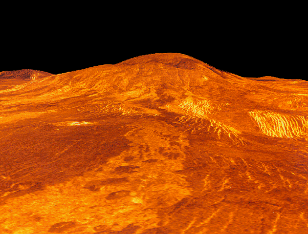
Sif Mons is displayed in this computer-simulated view of the surface of Venus. The viewpoint is located 360 kilometers (223 miles) north of Sif Mons at a height of 7.5 kilometers (4.7 miles) above the lava flows. Lava flows extend for hundreds of kilometers across the fractured plains shown in the foreground to the base of Sif Mons. The view is to the south. Sif Mons, a volcano with a diameter of 300 kilometers (186 miles) and a height of 2 kilometers (1.2 miles), appears in the upper half of the image. Magellan synthetic aperture radar data is combined with radar altimetry to produce a three-dimensional map of the surface. Rays, cast in a computer, intersect the surface to create a three-dimensional perspective view. Simulated color and a digital elevation map developed by the U.S. Geological Survey are used to enhance small-scale structure. The simulated hues are based on color images recorded by the Soviet Venera 13 and 14 spacecraft. The image was produced at the JPL Multimission Image Processing Laboratory and is a single frame from a video released at the March 5, 1991, JPL news conference.

