NOTE: Click on the image to view it at its highest resolution.
P-42386 MGN-117
May 26, 1993
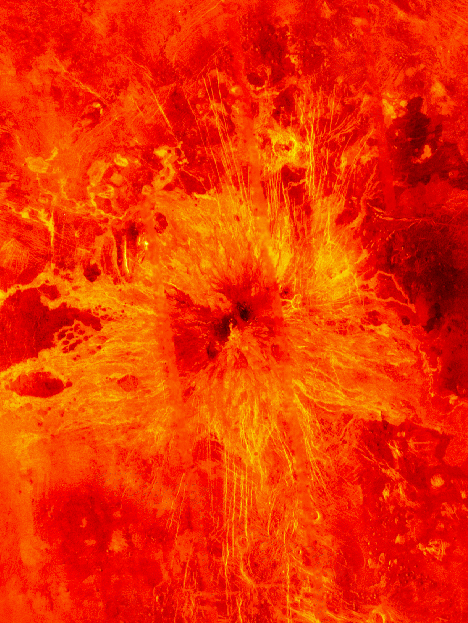
Ushas Mons, a 2-kilometer-high (1.25-mile) volcano in the southern hemisphere of Venus is shown in this Magellan radar image. The image is centered at 25 degrees south latitude, 323 degrees east longitude, and shows an area approximately 600 kilometers (360 miles) on a side. The volcano is marked by numerous bright lava flows and a set of north-south trending fractures, many of which appear to have formed after the lavas were erupted onto the surface. In the central summit area, however, younger flows remain unfractured. An impact crater can be seen among the fractures in the upper center of the image. The association of faulting and volcanism is common on this type of volcano on Venus, and is believed to result from a large zone of hot material upwelling from the Venusian mantle, a phenomenon known on Earth as a "hot spot." Simulated color is used to enhance small-scale structures. The simulated hues are based on color images recorded by the Venera 13 and 14 landing craft. The data were acquired during the third eight-month cycle of Magellan's radar mapping, which end in September 1992. Several narrow gaps in the Magellan coverage are filled with low-resolution radar data obtained by the Earth-based Arecibo radio telescope. The image was produced by the Solar System Visualization Project and the Magellan Science Team at the Jet Propulsion Laboratory Multimission Image Processing Laboratory. The Magellan mission is managed by JPL for NASA's Office of Space Science.

